Isaias Storm Watch
We will post updates here as we receive them, newest news at the top
Update of 8/5/2020 1pm
The Village wanted to provide you with a quick update regarding the cleanup of debris from yesterday’s storm. Our DPW crews have been out all day picking up and removing debris from our roads and will continue to do so over the next few days or longer.
We expect our crews to make several passes throughout the village so if you see our crews in your area or on your street picking up debris and leaving, please know that they will be back through at some point.
Property owners are responsible for the removal of any trees and/or large limbs that may have fallen on private property. There are still several streets closed because there is a tree down with wires.
Village staff are unable to clear any tree or large limb from a roadway if it is tangled in wires.
We must wait for the entity responsible for those wires to clear the wires before any debris can be removed.
As a reminder, if you are without power, please contact PSEG at (800) 490-0075 or text 773454.
Our crews are working hard and as fast as possible to restore the Village.
Update as of 8/4/2020 6am

Update as of 8/3/2020 5pm
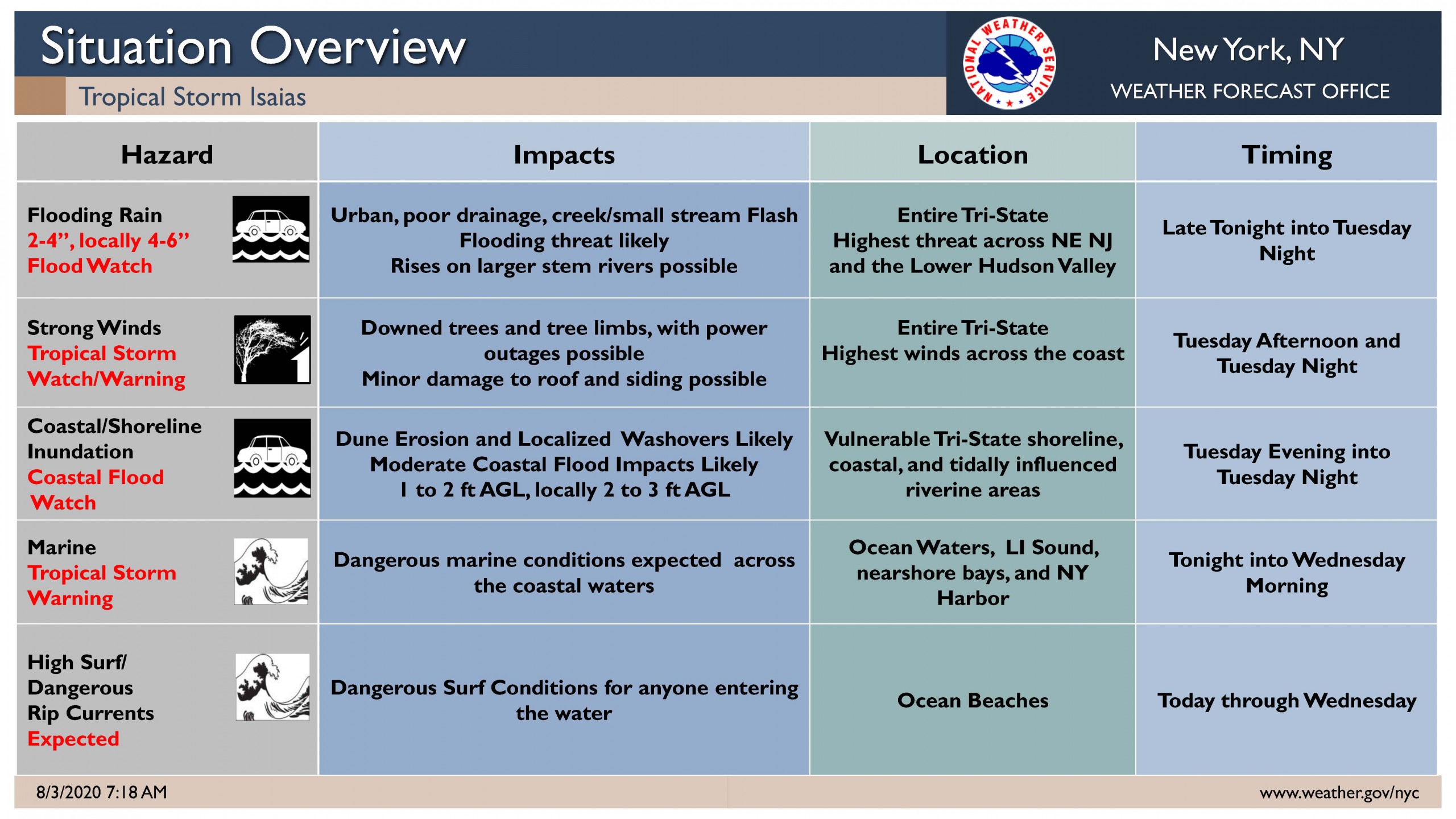
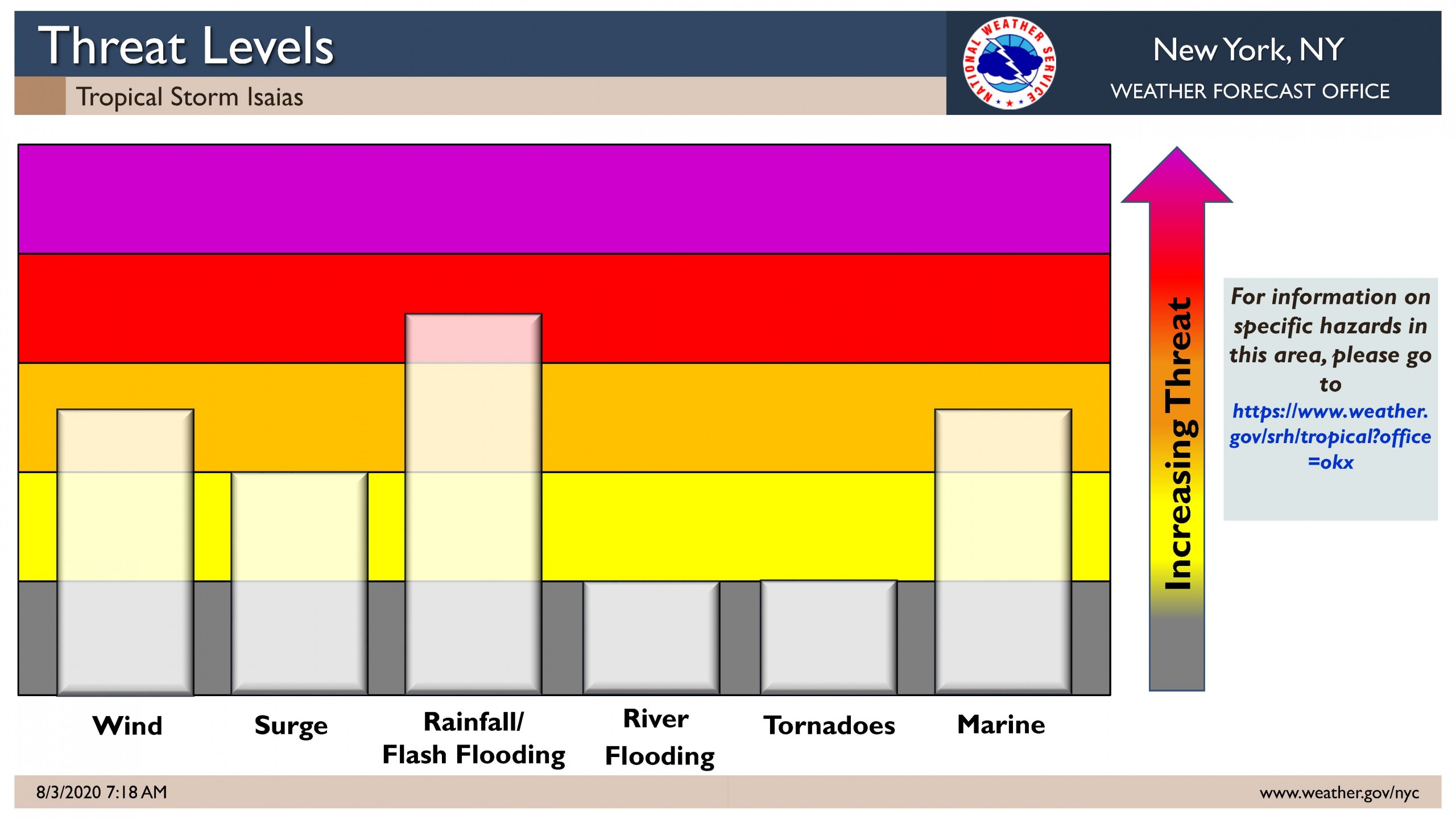
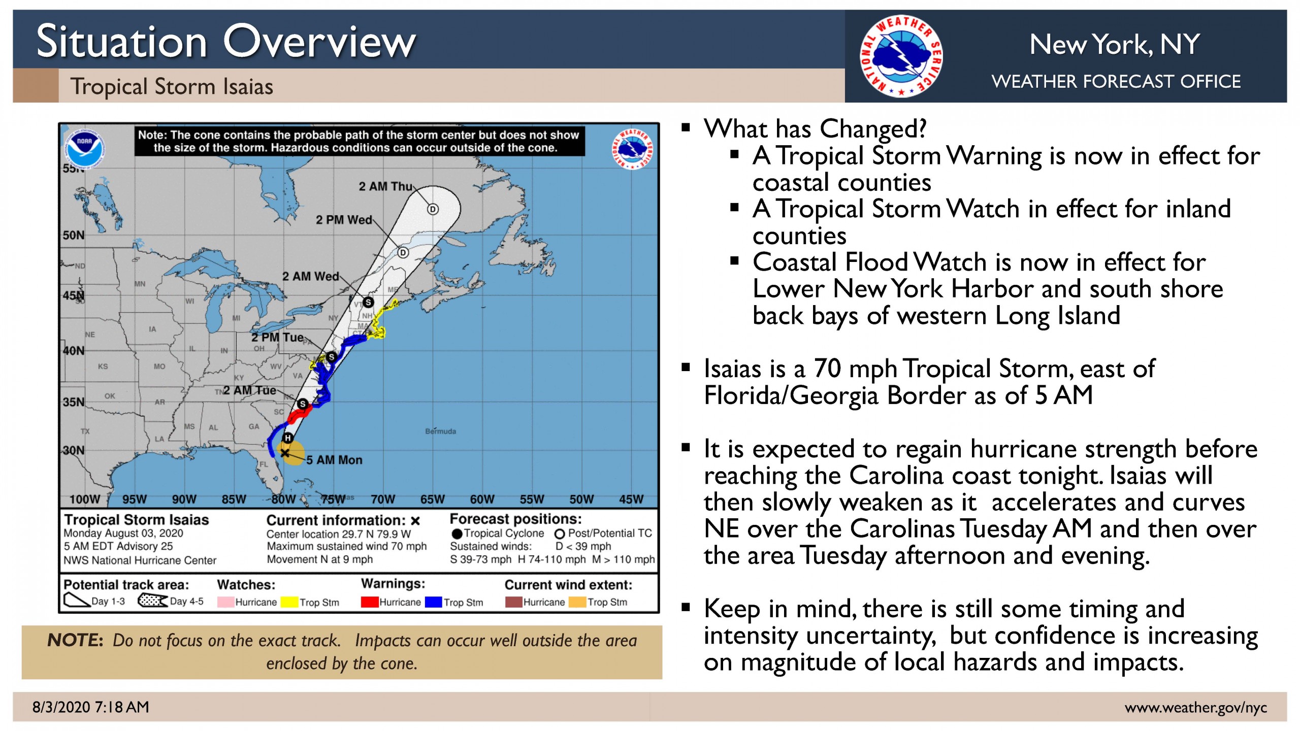
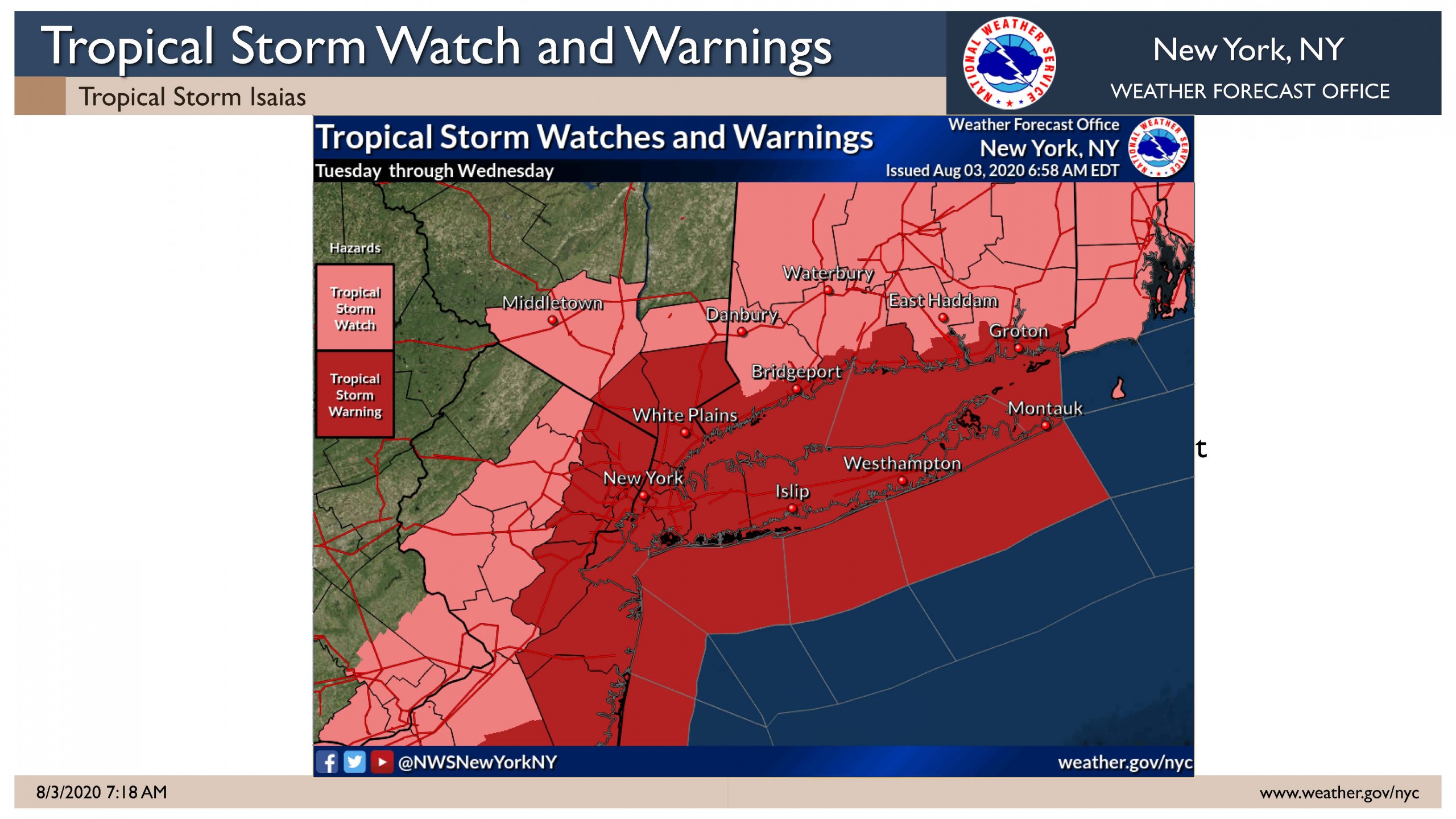
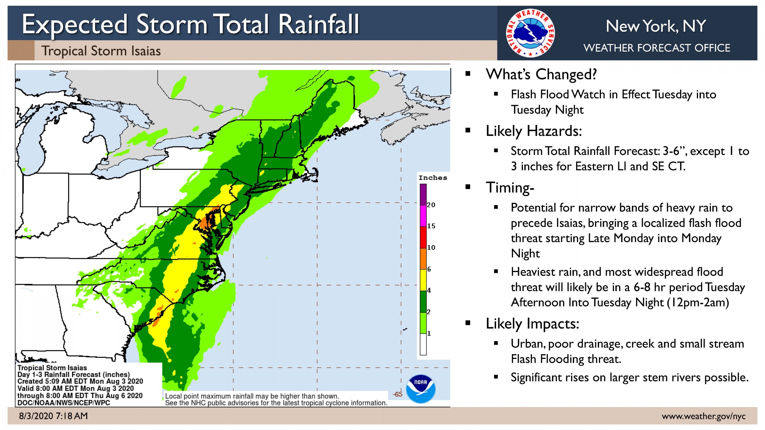
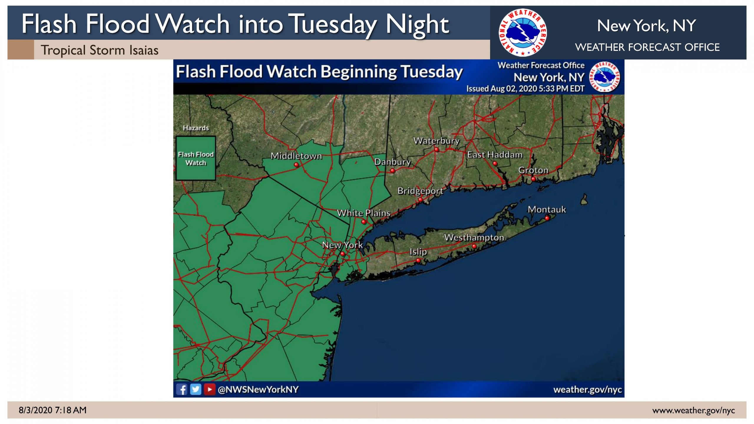
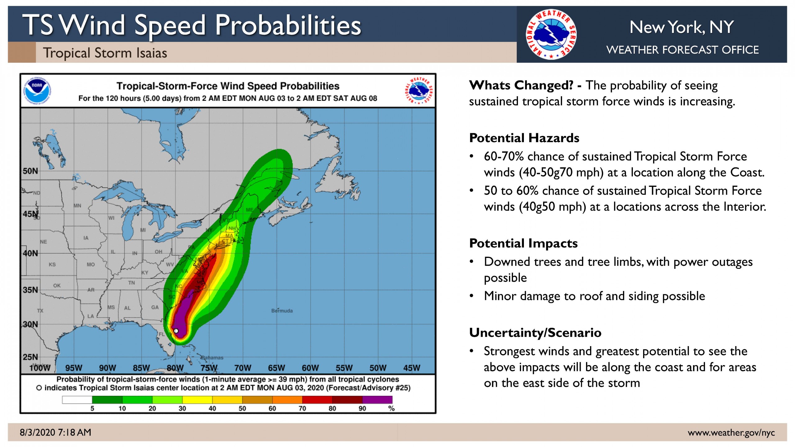
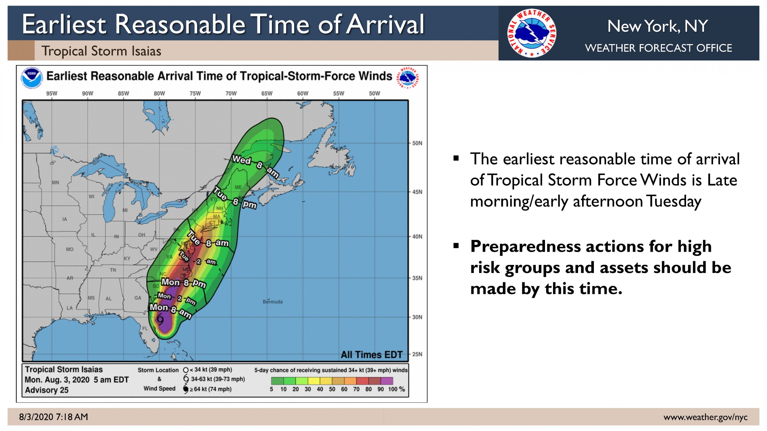
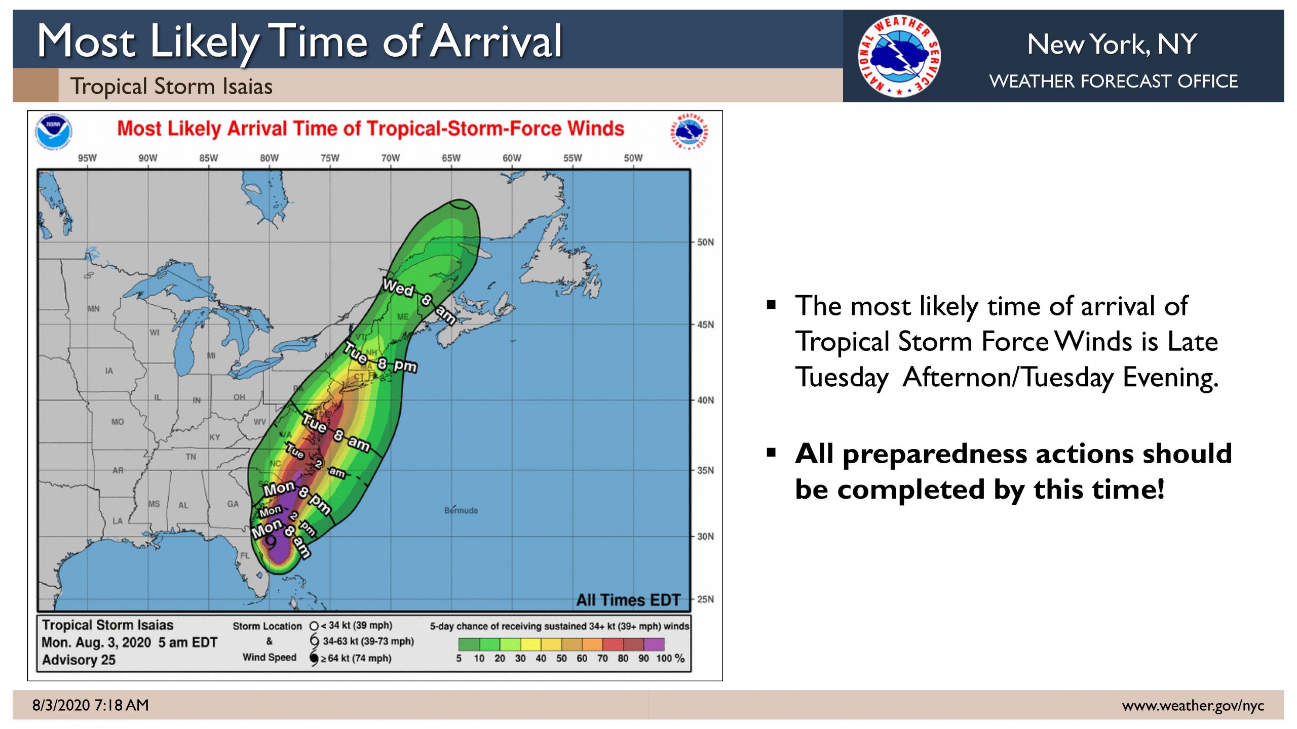
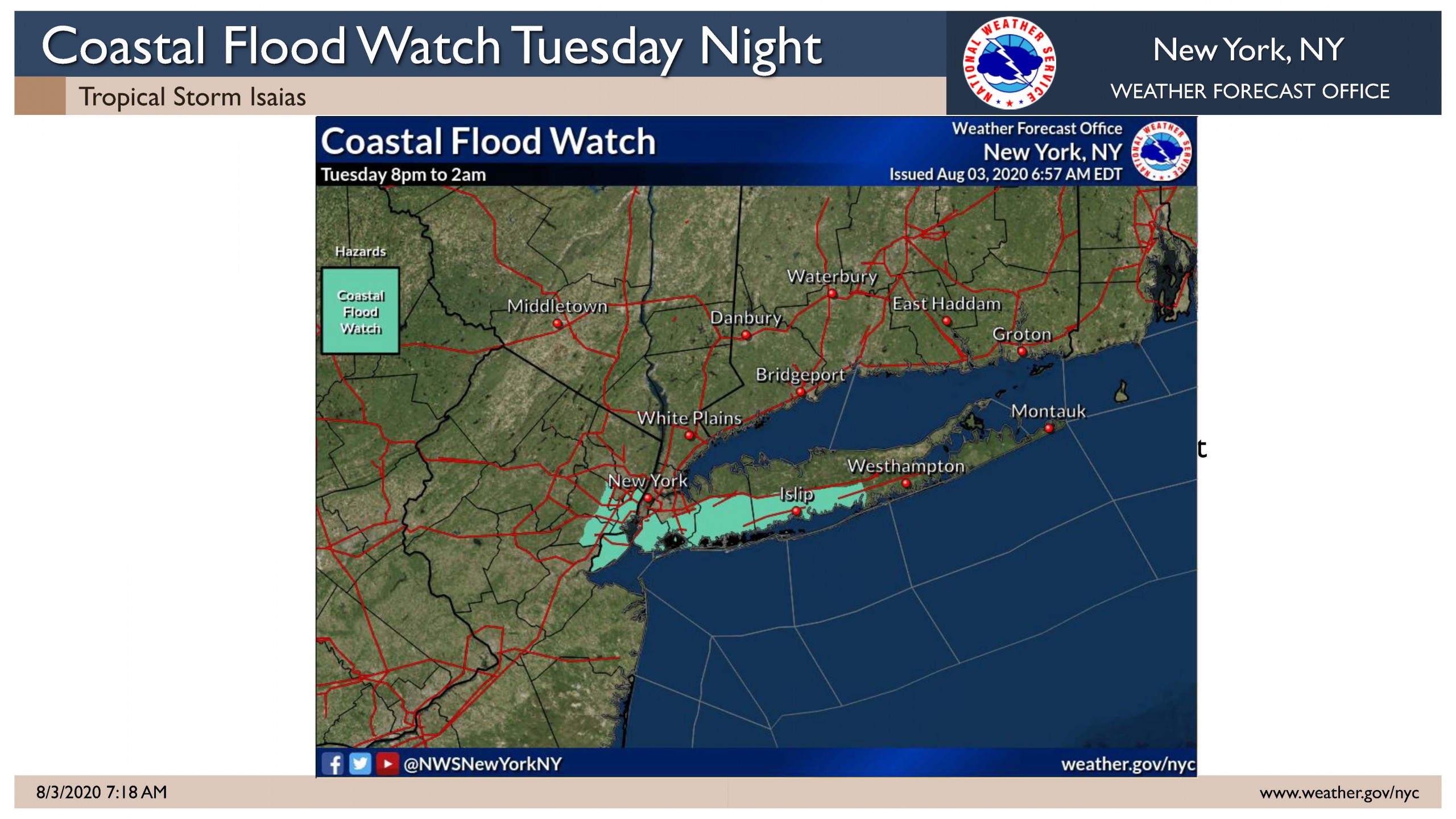
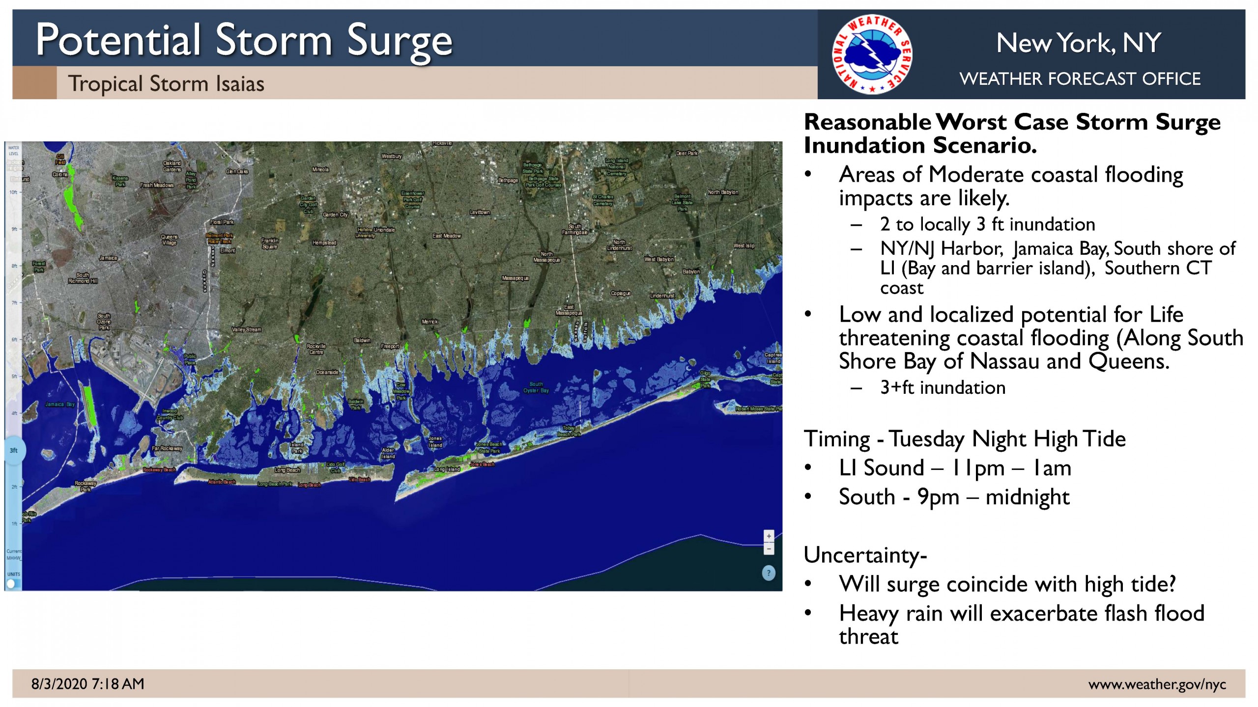
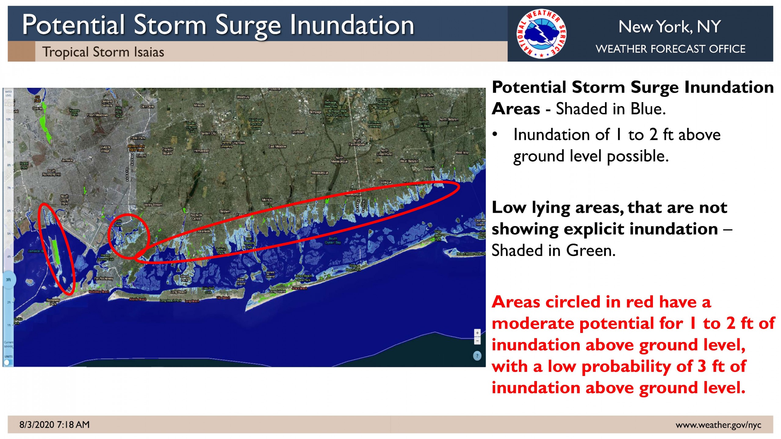
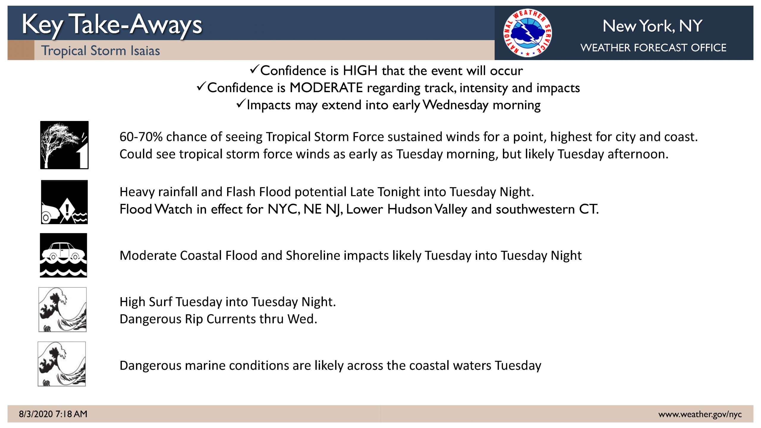
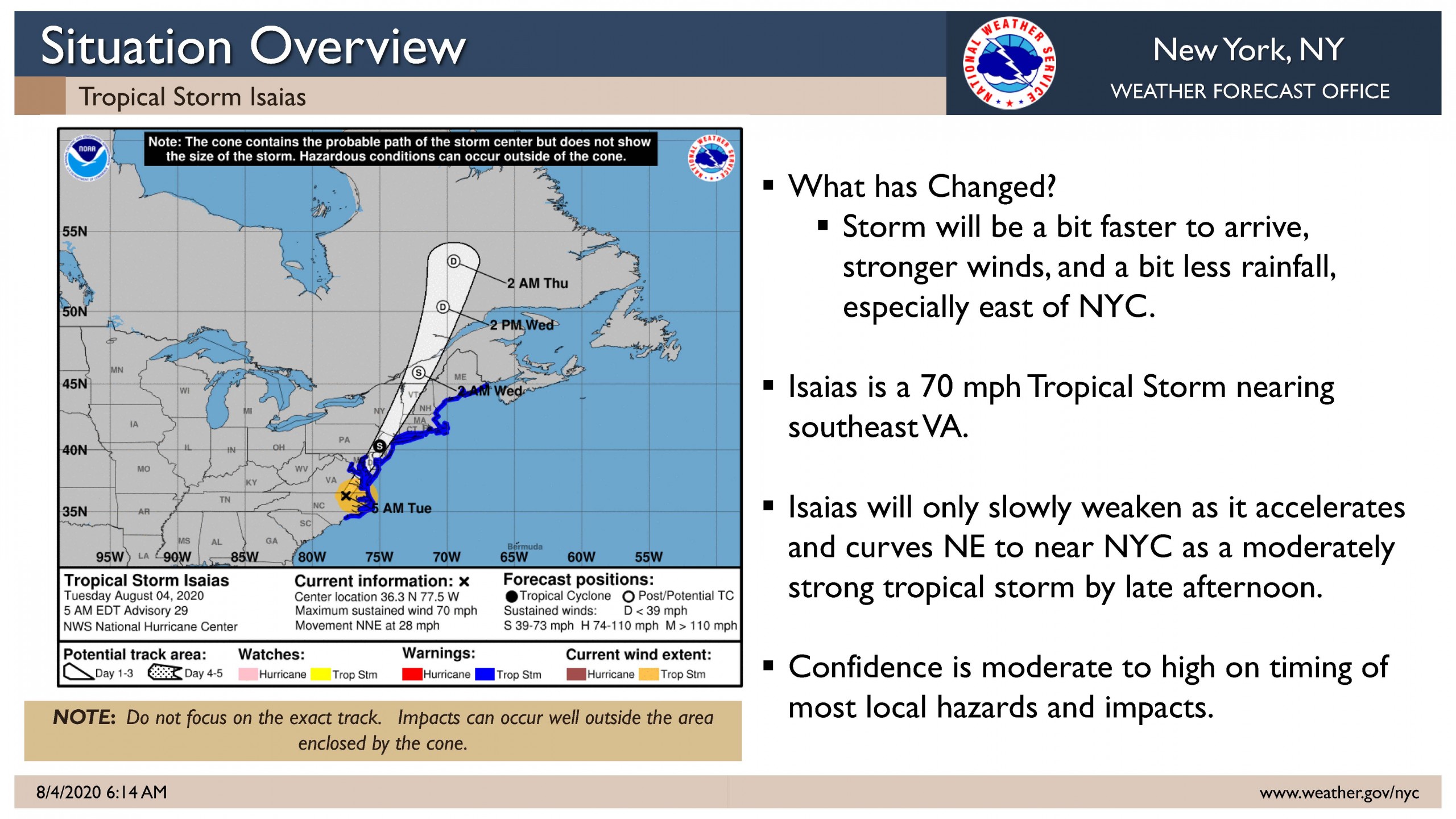
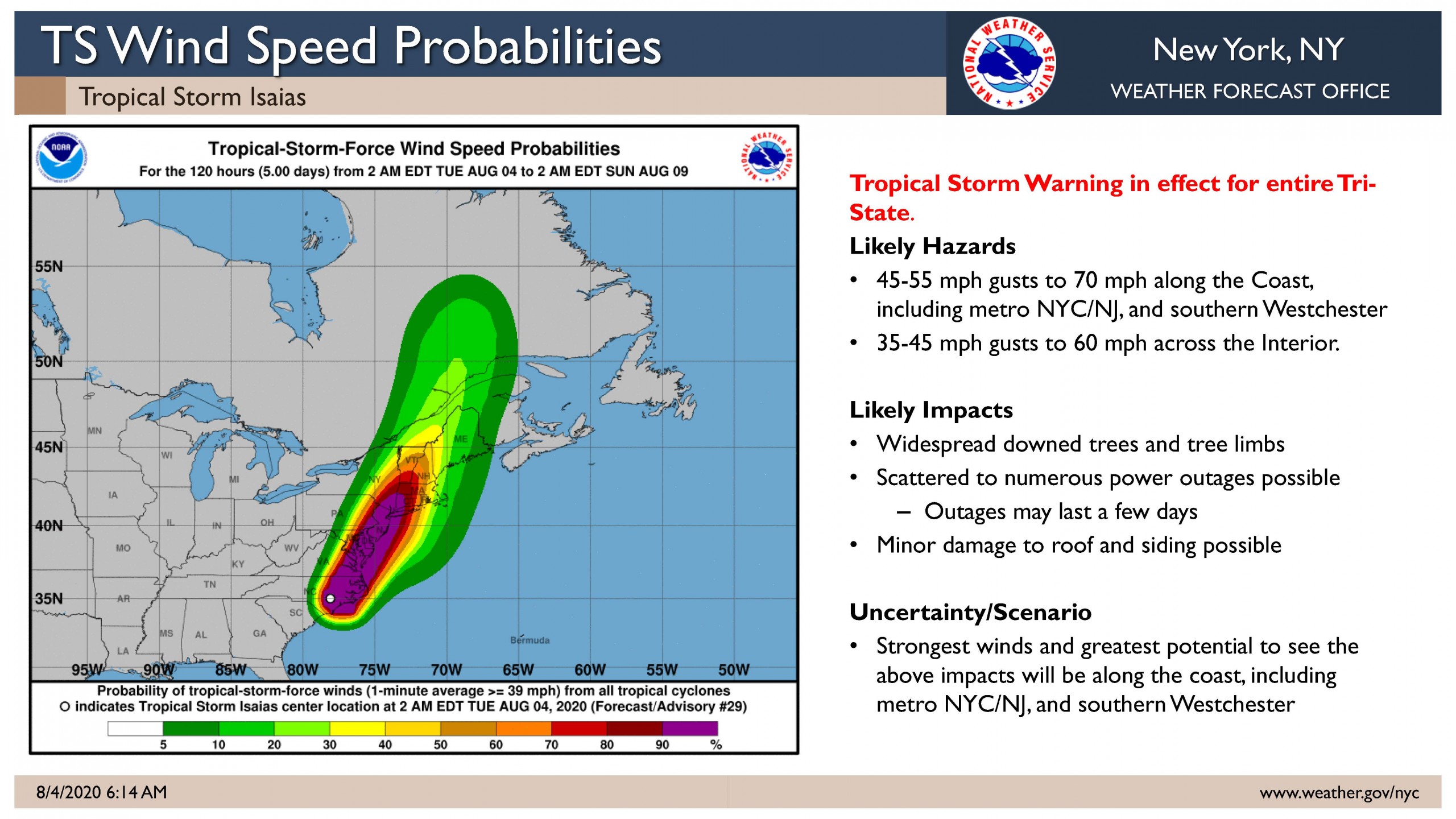
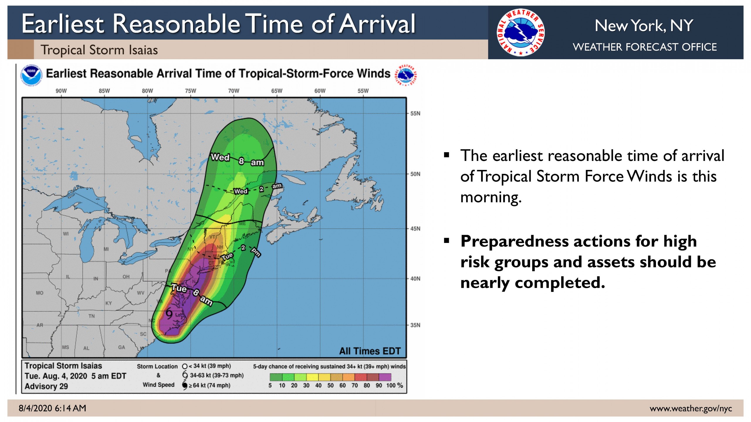
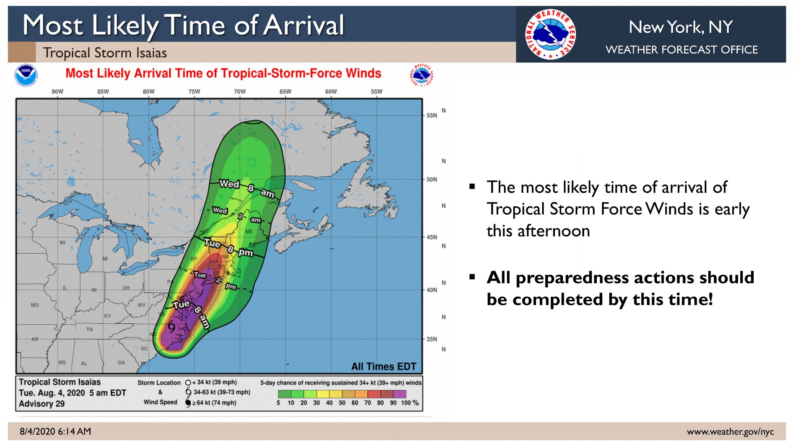
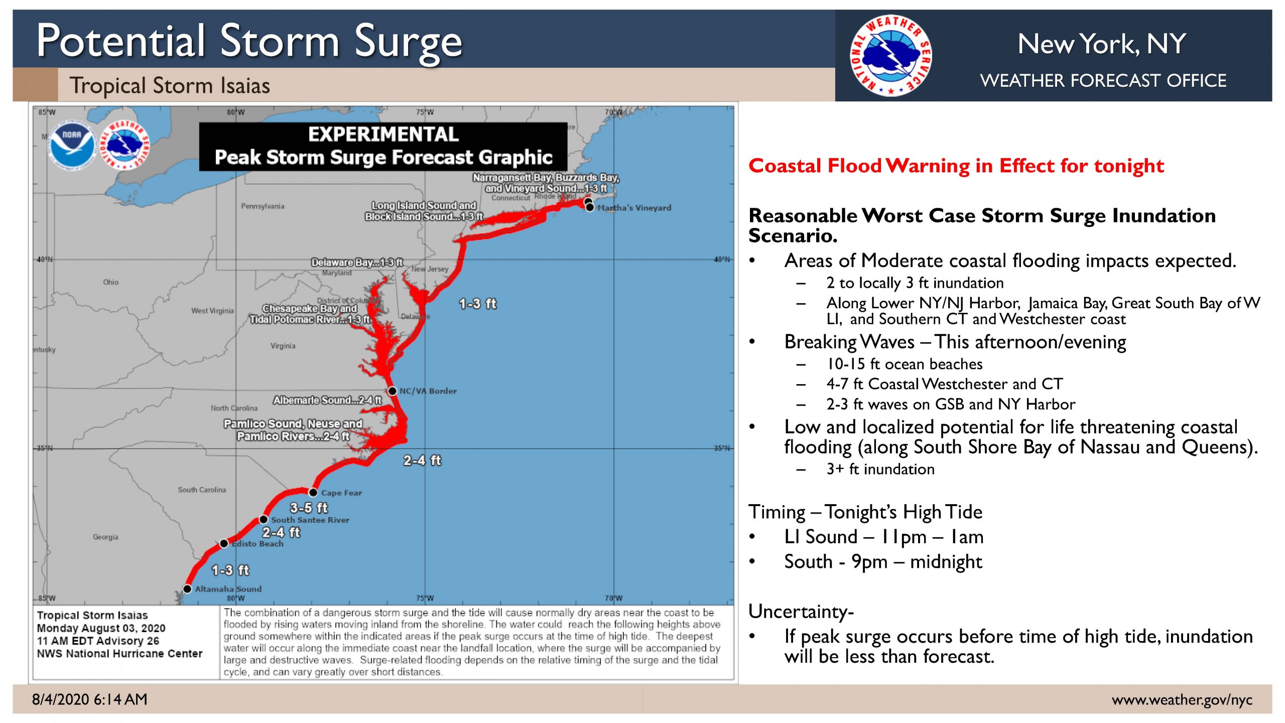
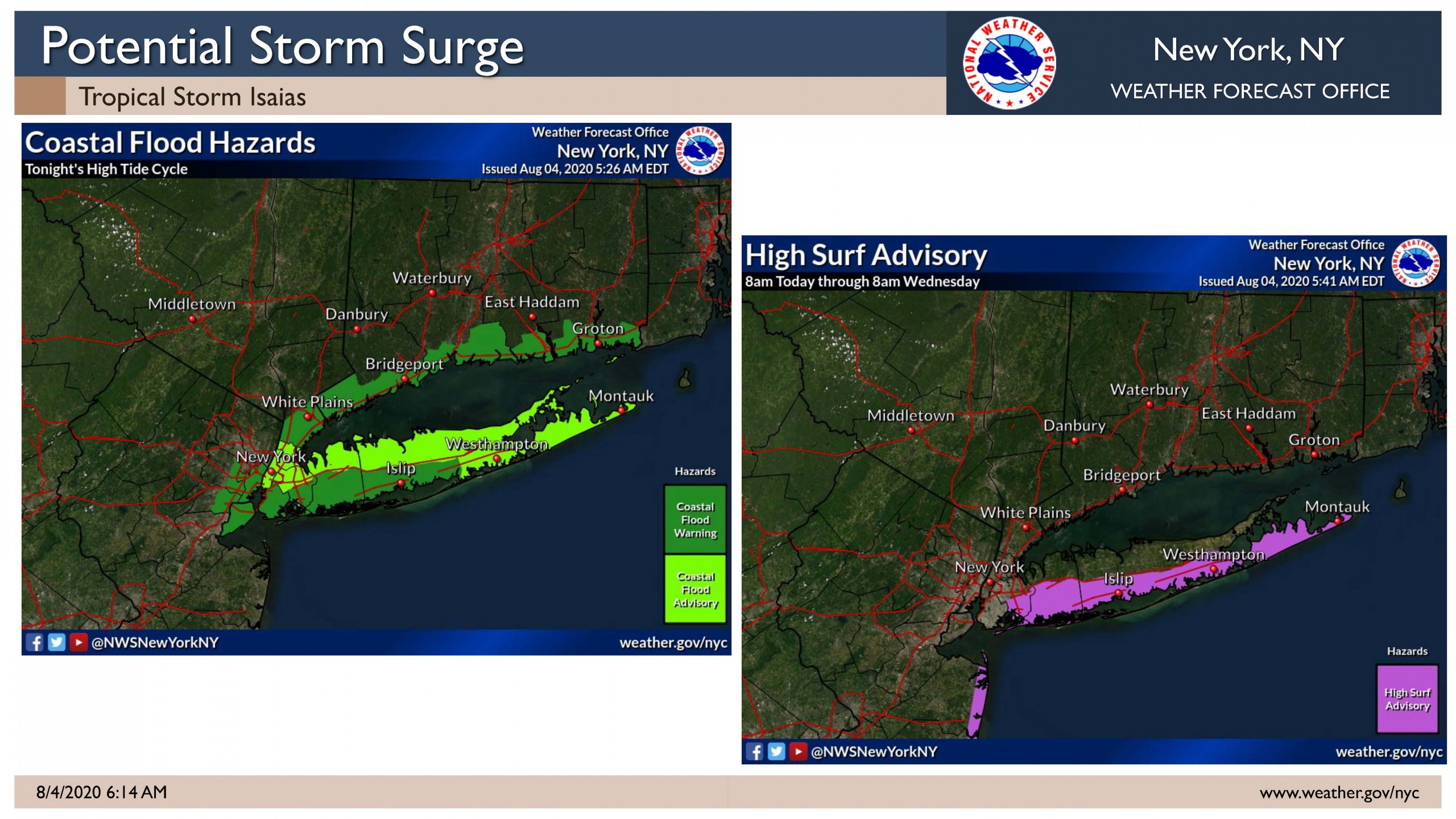
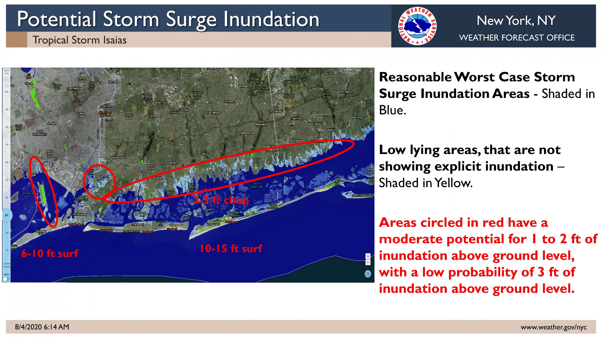
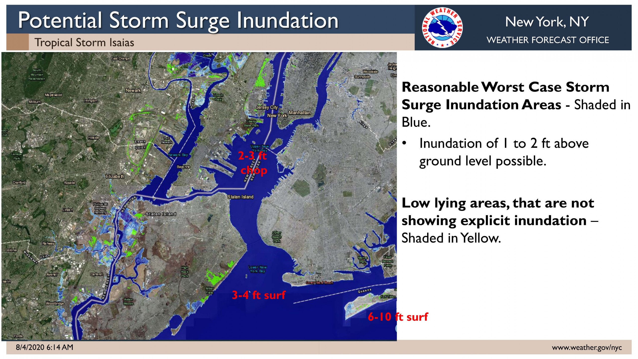
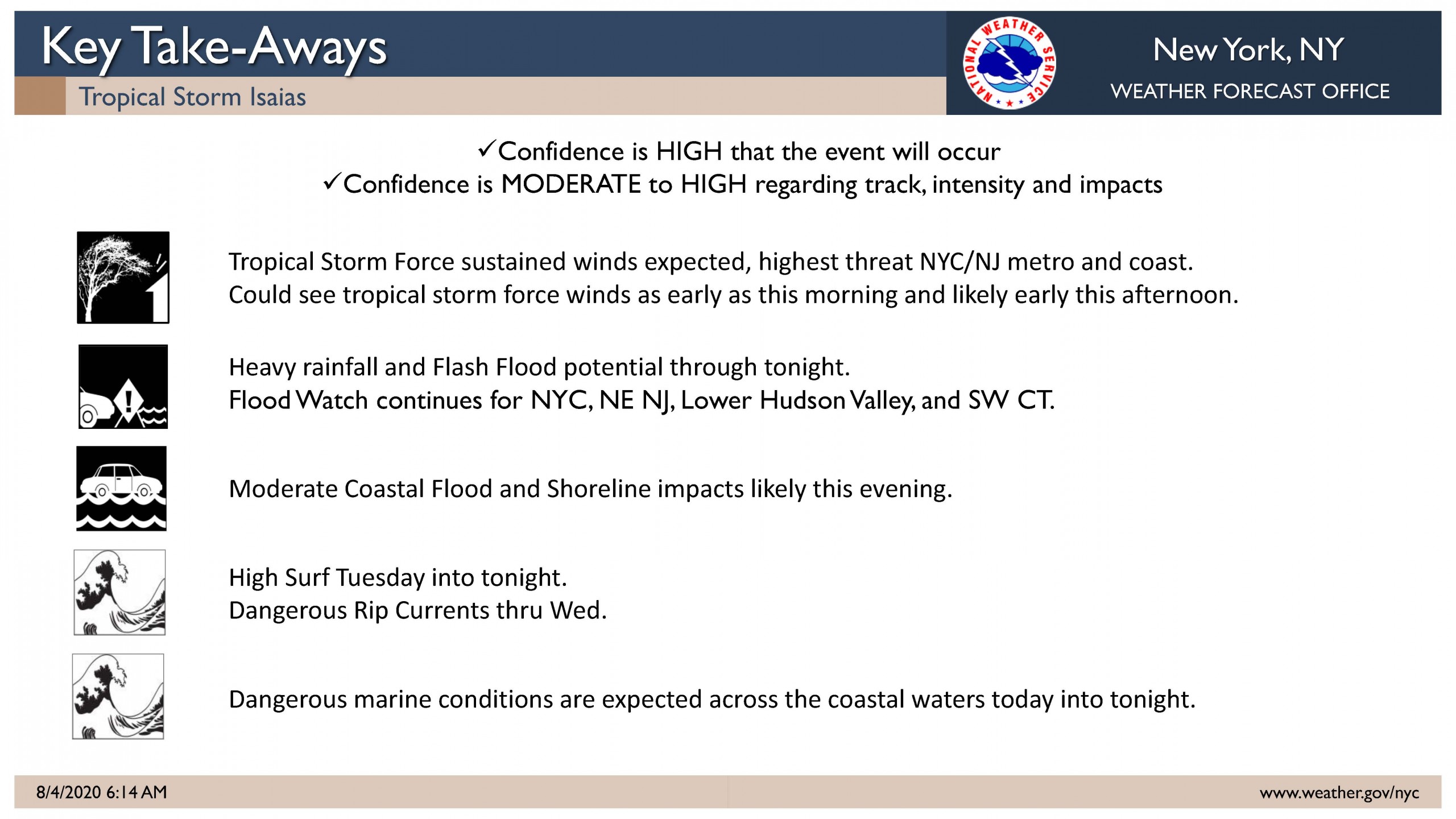
As of the 2:30 PM NWS briefing, the storm is tracking faster and a bit to the west. There is a possibility for Isaias to become a Hurricane again, but will weaken back to tropical storm status prior to reaching the tri-state region. Rain is expected to begin late tonight, with the heaviest of rain between 10:00 AM – 10:00 PM on Tuesday. Moderate coastal flooding is likely, with the deciding factor of surge inundation to be if the tropical storm force winds coincide with the high tides. There is now a 55%-75% chance of 45 mph – 50 mph sustained winds with gusts 60 mph – 70 mph.
Update from PSEG as of 8/3/2020 4:30pm
Dan Eichorn, President of PSEG gave an update message about the impending storm for tomorrow.
He discussed Safety, Weather, Manpower, Logistics & Preparations and Communication.
The storm is expected to be at its worst Tuesday afternoon through evening and out of our area by Wednesday morning. They are expecting high winds in Suffolk County with gusts from 45 – 60 mph with possible lighting and thunderstorms; coastal flooding on the south shore and it potentially could be the worst storm since Superstorm Sandy. PSEG has out of state utility workers headed to LI plus their current PSEG employees and they are well prepared for this event.
PSEG has texted all their customers today and in the event of an outage in their area they can reply OUT back on the text. Their website is updated with a weather banner and you can report outages and downed wires on their website https://www.psegliny.com/ , as well as on their Facebook page.
OUTAGE CALLS can be made to 800-490-0075
OUTAGE TEXTS Can be sent to 773454
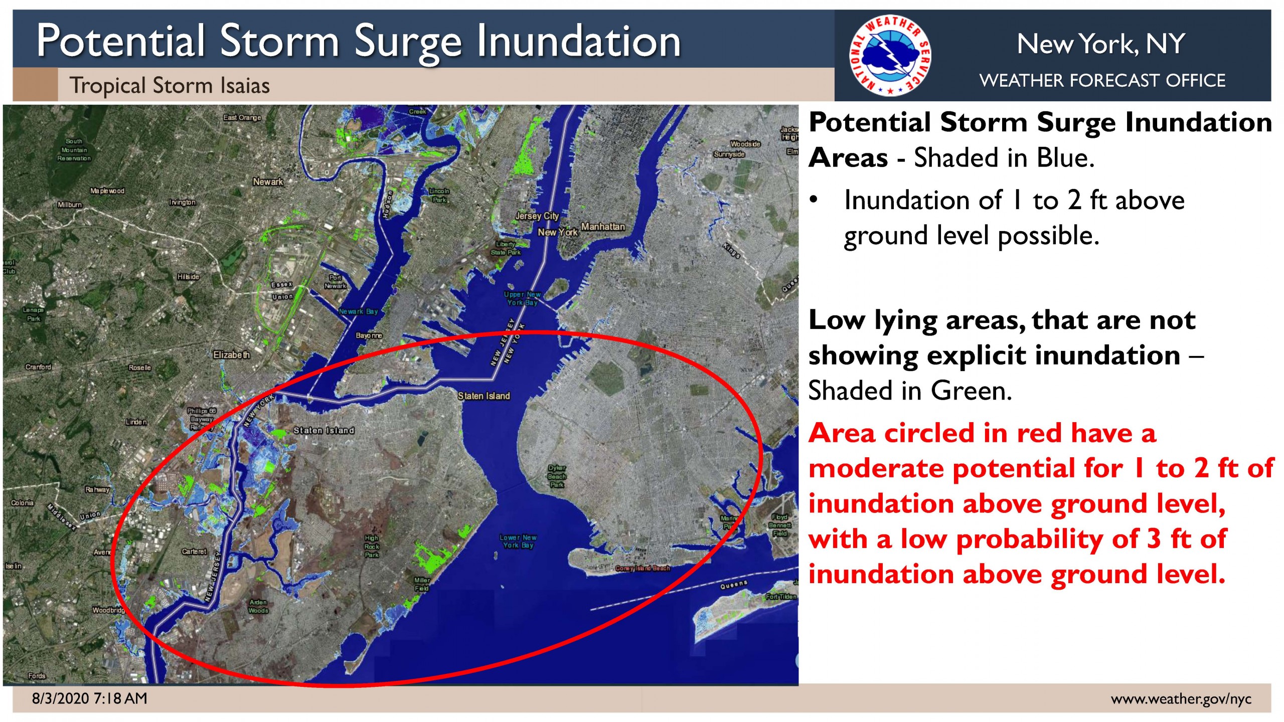
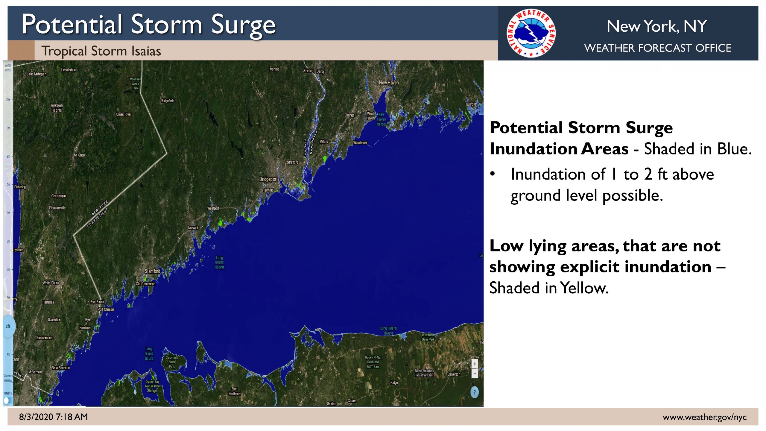
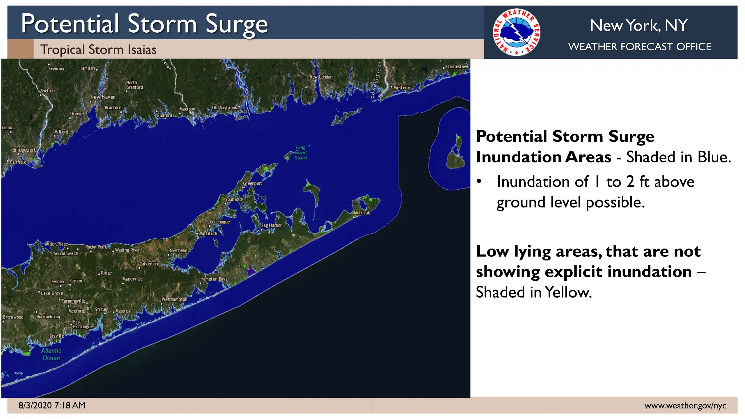
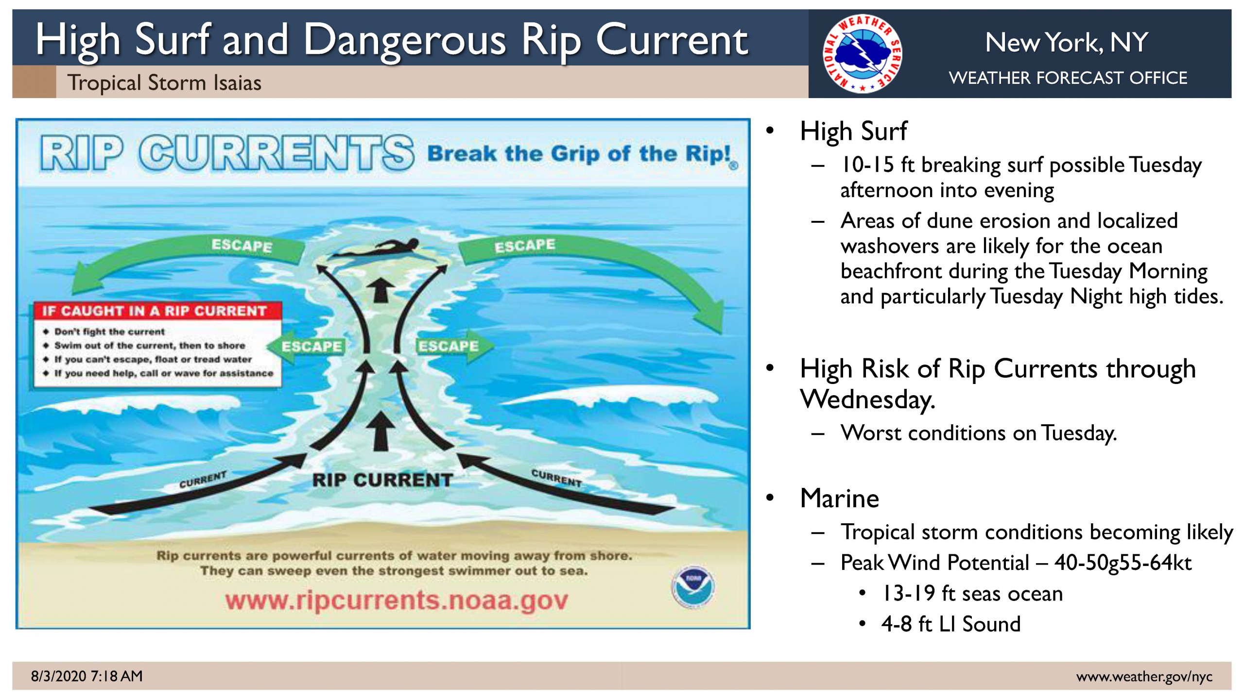
Update from 8/3/2020 at 7am